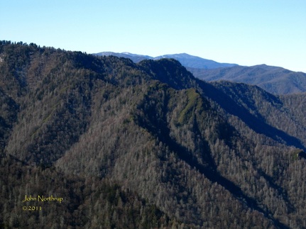
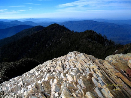
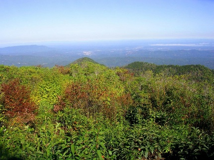
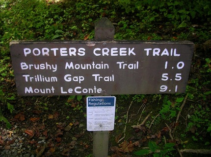
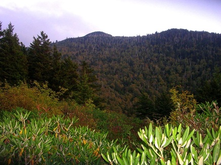
Rarely do I ever describe my hikes around LeConte, but our two treks up and down (and vice versa) the two halves of the Bull Head Trail warrant some attention. 
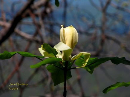
Much to my amazement, the Fraser Magnolias were blooming at the mid elevations. 
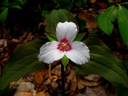
Even the painted trilliums got off to an early start this year, a pleasant surprise.
0 Comments
Coming into this trip, we had it set in our minds that we would like to make a trip up Mt. LeConte and pay a visit to the lodge in its winter dormancy. Of course, the biggest factor in our decision making was the weather. If it was snowing or raining during our time in Gatlinburg, or if the trail conditions were hazardous or impassable, then we weren't going to bother with it. Fortunately, the weather on our second day was supposed to be our best day, with spotty morning fog giving way to clear and sunny skies. Combine that with the fact that snow totals atop the mountain were under a foot and all cables clear, we saw a great opportunity to get some work done and enjoy ourselves in the process. So it was an early morning start into the park after fueling up on some donuts. We drove through some patchy fog before the reaching the trailhead, but it was dissipating for the most part. What was really neat was that the condensation from the fog stuck to the trees in the shaded areas and froze, giving them a nice shiny look. So many of them glimmered in the morning light passing through the valley. Reports told us that despite the recent nice weather, Alum Cave Trail was icy from top to bottom. This could be extremely dangerous for anyone not properly equipped with some sort of cleats for boots. Having worked at the lodge, we were both prepared for the conditions ahead and came along with our "stabilicers." We'd use them the entire way which in turn made our trek pass with ease. There is no substitute for sure footing when it comes to hiking this time of year. A great deal of time and energy can be wasted trying to navigate around snow and ice without the proper footwear. As soon as we crossed the first bridge over Walker Camp Prong, we were greeted with a sheet of packed snow. The stretch of trail between the parking lot and Arch Rock saw a number of downed trees blocking the trail. We weren't the first hikers to stumble across them because limbs had already been snapped to form a tunnel through the tangled messes. Hopefully they'll be cleared by trail maintenance crews before we have to return to work in March with our much larger packs. Since the trail parallels the creek for the first part, we were quick to notice how clear that water was like we had yesterday. It must have to do with the cold or the snow melt. I remember making the same observations hiking up this very same trail last year in March. Maybe it has something to do with the lack of foliage as well. Before we reached Arch Rock we finally broke out of the shade and into the sunlight. Immediately I felt myself getting warmer and decided to stop and shed layers. Despite the cool temps and the presence of snow, it is important to shed layers during your ascent. You do want to work up a sweat because as soon as you stop, all that water on your skin and in your clothes will make your body too cold and/or too fast; thus, encouraging hypothermia. Since you are moving constantly, your blood flow will do enough to keep your body warm even in a short sleeved shirt. If you do decide to stop for a little bit, then it would be wise to put your dry layers back on and maintain your warmth. We stopped long enough to remove one layer and get a drink of water, then it was back to moving. Arch Rock, with all of its constant shade, was pretty well iced over on the inside. Luckily, the steps were clear, but it would have been a mess if they weren't. Somewhere in the half mile between Arch Rock and Inspiration Point we came across a rocky outcrop that sees a lot of water runoff and sits in the shade. Its surface was coated in icy columns, several of which had broken off due to the warming temperatures of late. There were at least three massive pillars of ice that had disconnected from the others and fell right onto the trail. The chunks themselves were still intact and looked rather impressive. By the time we had reached Inspiration Point, all of the fog had burned off and the skies above were clear. The views were also astounding as far as we could see. We had passed a handful of hikers along the way, some of whom had stayed at the backcountry shelter the night prior. We were high enough in elevation now while being on the south side of the mountain that the sun had done a decent job of clearing the path of snow before the bluffs. We were glad to see that the notorious, car-sized icicles that fall from the bluffs had already thawed and gone. The only ice remaining there was a glaze on the rocks directly below where water constantly trickles down from the top of the bluffs. We saw one more group of backpackers here and they would be last people we came across the rest of the afternoon until our return. Once we made our way around the north side of Peregrine Peak and past the halfway point, we were back to walkin on snow and ice. No worries though because our stabilicers were holding up just fine. The rest of the way up Alum Cave was as monotonous as ever, walking through the woods, heading in the same direction, stepping over rocks, roots, and snow. The most entertaining part was when I come across snow that was in the sun and had become packable. I'd look back at Bonnie, and if she was far enough away I could roll up a snowball real quick without her noticing. After a few close calls she finally caught on to me and made me stop. I would comply...until later...haha! Anyone who's done the hike up Alum Cave to Mt. LeConte knows that the views get better the higher you get. Some of the best places are at the rockslides below Cliff Tops that afford grand views of the Smokies main ridge and the valley below. The view of Chimney Tops was especially clear this day. Having done this particular hike over a hundred times, I know exactly where I'm at and what to expect the entire way up. That's why it's always such jubilation when I reach the crest of the mountain at the old horse gate a quarter mile from the lodge. After that point, the rest of the trail is flat. Neither of us had ever been up here at this time of year, but because the snow totals were on the lower end this winter, we weren't seeing anything we hadn't already seen before. The mountain looked like it typically does in March or November. Yeah we were hoping to get to experience Mt. LeConte in all its winter wonder, but we were pretty ecstatic about being able to reach the top without a scratch. It was an undescridable feeling to reach the lodge and see all the cabins again after two months. It truly felt like we were back home. The place we had come to know and love was still there waiting for us. As we stood at the top of camp and looked out, the entire valley to the north was below the clouds and here we were above it all. What made it so unique this time around was that we had it all to ourselves. Alex, the winter caretaker was off the mountain for the afternoon tending to some business in town, so not even he was there. There were no dayhikers, no shelter folk, and no guests because the lodge is closed. It was so quiet, and calm, and perfect. It was just Bonnie, me, the mountain, and a gorgeous day. How cool is that? Our other reason for bring there was to make some preparations for this upcoming season since we are both returning. We tended to some things regarding our respective crew quarters after we warmed up in the kitchen and ate some chow. When we finished with our business, we wanted to make a brief stop at Cliff Tops. Since it sits on the mountains southern face, it loses its snowpack the fastest, so all of the jagged rocks were dry and bare. Looking around, there wasn't much snow to see because all that remained was on the ground and not on the trees. The views were delightful and the mountains in the distance were in varying shades of blue. It was difficult to leave, but we knew we didn't have much daylight so we had to head down eventually. We never saw anybody the rest of the way down between the lodge and the bluffs which we found interesting given that it was such a beautiful day. Oh well, guess everybody missed out except us! It was incredible to see the lodge again, but we won't be back again until another month. Hopefully this trip will be enough to hold us over.
Journal describing my 50 mile hike fest up, down, and all around Mt. LeConte in one day coming soon! Ever wonder what The Jumpoff looks like at night? Here ya go! Arriving at Myrtle Point around 7:30 to catch the sunrise. The grassy Helipad located near the Lodge. Catching some early morning light from Cliff Tops, though famous for its sunsets. One of three trips to the Horse Gate along Alum Cave Trail, the midway point of each lap between there and the Alum - Rainbow junction. Stack of boards near location of former Horse Barn just up from Trillium Gap Trail. View from Brushy Mountain towards Pigeon Forge at trail's terminus. Arrival in Greenbrier at 11:30, excited about how little time it took getting down. Looking down on the Roaring Fork Motor Nature Trail, just reopened that morning, from the Trillium Gap Trail. A late afternoon pass by a decently flowing Rainbow Falls. View of Mount LeConte from the Rocky Spur after sunset. Crossing the finish line in 16 hours and 48 minutes...what a day!
The month of May can be most memorable on the mountain when the mountain myrtle blooms. (How's that for alliteration, all you teachers out there?) Visiting places like Cliff Tops, Myrtle Point for which it is appropriately named, and the connecting trails like Rainbow Falls' Rocky Spur or Alum Cave's Inspiration Point at this time of year makes for quite a scene. Sure, there are great patches of the myrtle in bloom trailside, but you've got to be willing to climb a few rocks and get scratches from tree branches if you want to see the best displays. On LeConte, there are so many areas to explore in one's free time, and since the sand myrtle prefers to grow on cliff sides and rocky mountain faces, it made sense to wander around those famous points right in my backyard. Bushwacking up the ridge of Cliff Tops may seem daunting, but is a relatively easy climb once you figure it out, and the rewards are commendable. The views from the handful of vistas along the way and the dense patches of myrtle that cling to the cliffs continue to get better as you make your way up. Another great bushwack is to take a path that leads down the face of Cliff Tops, taking one about a third of the way down to the Alum Cave Trail just below. When the cliff itself angles inward to the mountain, you know that means it's time to stop going down, or else bad news bears. There you get views of Cliff Tops from the middle, with rocks, sand myrtle, and rhododendron growing all around you, a change from the typical view one gets up top. Obviously, Myrtle Point is the place to be. Not many of the bushes around the immediate vicinity of the point are in bloom, mostly do to the erosion of the soil that the bushes like, but a good number produce decent blooms. There are a number of ridges that extend down from the point and run down to meet The Boulevard on opposite sides of the mountain. If you're willing to push your way through the brush on those, you won't be disappointed. Taking the ridge that turns to the north has the best display of sand myrtle you'll see anywhere. The bushes are large and abundant with blooms forming a dense blanket of white, red, and pink. Add to the mix the fact that your on a narrow ridge with great panoramic views of the valley below and the slopes of LeConte. I also discovered this week that the same ridge makes for a great place to watch the sunset, another break from the traditional Cliff Tops. On Monday, I woke up with a ton of energy and ambitious plans for a hike. I had the afternoon to myself and wanted to venture far. Even though the weather was a little sketchy at times, I wouldn't let it bother me, for I just wanted to be out and about. I had been to The Jumpoff before, but wanted to go further this time. Charlies Bunion would add more miles, but I was just there a week ago. Then I thought, aim farther east of the bunion, an area I've only ever seen in the clouds and rain. It was ambitious, but it was just the drive I was looking for that day. All the way across The Boulevard, I was moving in and out of clouds, sunshine, and mists. I was up and over Mount Kephart before I knew it and made it to the bunion in just over an hour and a half. Before I even left for the day's hike, I determined that wherever I was after two hours of hiking, I would stop and turn around to make it back to the lodge in time. So at this point, I pushed eastward along the AT. When I got to the clearing just before Dry Sluice Gap, I had a clear view of the valley to the south that is the Kephart Prong watershed. Past the gap I began to make my way up and over the start of The Sawteeth. Appropriately named because the ridges at this point are jagged like a saw blade and extremely narrow in places, like two or three yards wide with drop offs. The trail was often lined with thick patches of yellow bead lily in full bloom. The views are outstanding on a clear day...something I had never experienced here....until now!!! One can look back along the Smokies main crest and see the steep, scarred slopes of Charlies Bunion and another point which almost looks like a miniature Half-Dome. I remembered seeing the side trail that led the point's summit, so at an hour and fifty minutes in, I decided to turn back early and make my way up to the unheralded vista. As I ascended the rocky trail, it started to sprinkle, but luckily the clouds remained high enough for me to take in the views. The panorama is nearly identical to that of Charlies Bunion...rocky ledges with vertical dropoffs, overlooking the valley into Porters Creek and the spine of the Smokies to the east. A few differences are that you are higher up and instead of sand myrtle there was Catawba Rhododendron in bloom. Another sign that summer is just around the corner. This time I couldn't afford to linger, but I look forward to returning to this great lookout in the near future.
It was time to hike somewhere different, and with all the clouds I wasn't going to concern myself with looking for views. I was curious about the trail conditions along the Bull Head Trail. From what I had seen two days prior, the trail had not been broken. When I reached the junction, a few tracks could be seen from the park service crews that cleared the blowdowns the day before, but many of them had been recovered. The trail was treacherous in many places, especially as it made its way around the slopes of West Point. It was nice to be equipped with my Stabilicers and Leki hiking poles, because without them, there were a number of instances I could have been rolling downhill for a long way. Several stretches were drifted over to stomach level, and whatever trail existed was like walking a tight rope. I could see that the snow line along the northern face of the mountain was around 5,000 feet, but the other side of the LeConte crest told a different story. As soon as the trail swung to the south side of Balsam Point, the snow vanished and the path was clear. Weather on the mountain is a peculiar thing...to the north, winter...and to the south, spring. Unfortunately, my way back to the Lodge meant no green and lots of white.
|
Thanks for visiting!I appreciate you stopping by. This site is for your enjoyment as much as it is mine. Look for new photos and journal entries about every 1-2 weeks. Archives
November 2011
Categories
All
|